
Haverstraw Neighbors by Block
A block lookup begins with the relationship between an address and the parcels around it. The map identifies geometry and adjacent lots. The Town roll and tax search identify an owner or tax mailing contact for a parcel. A recorded deed can confirm an ownership interest at a date. Historical directories can add a dated address lead. These are separate kinds of evidence, so a list of nearby parcels should never be presented as a live list of everyone at home.
| Source | What it shows about a block | Access |
|---|---|---|
| Rockland GIS adjacent-parcel map | Parcel geometry, address or Tax ID, roads, municipal boundaries, and district layers | Free county map |
| Town PROS assessment roll | Current or prior owner result, situs, tax mailing address, SBL, assessment, and exemption fields | Free Town search and annual rolls |
| Town BAS tax search | Bill, tax map, property address, owner name, receipt, and collection-year history | Free Town portal |
| County Clerk deed index | Grantor, grantee, recorded date, legal description, and instrument trail | Guest view with copy rules |
| Rockland cross-reference directories | Historical address-to-subscriber leads for 1978-99 | Rockland Room or library research |
The Town BAS tax search permits bill, tax-map, property-address, and owner-name searches by collection year.
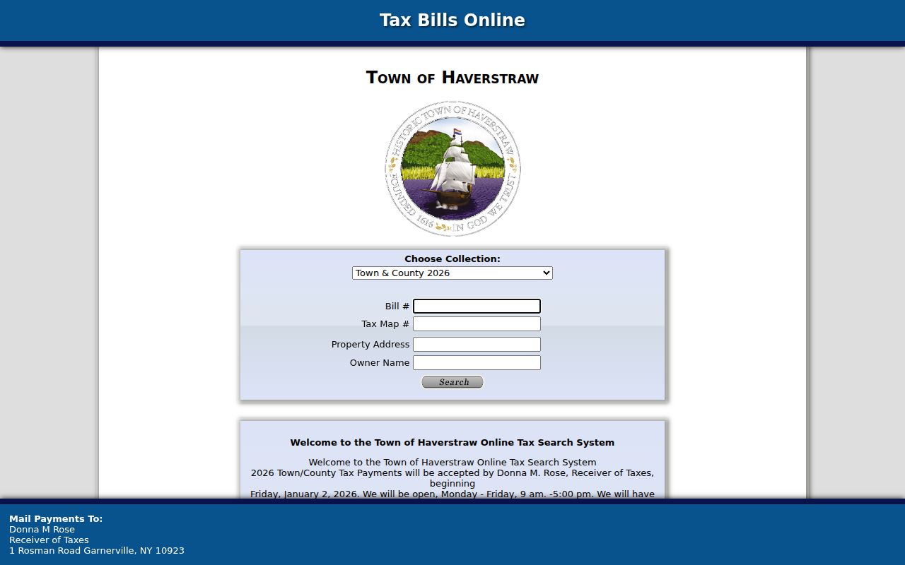
A tax bill or payment trail is not title, and a tax payer is not automatically the person using the property. Treat each displayed field as a record relationship with a source date.
Map Haverstraw Neighbor Parcels
Rockland GIS supplies the practical official method for identifying a Haverstraw block. Search the anchor address or Tax ID, zoom until the parcel polygon is clear, and turn on the tax-parcel, road, and municipal-boundary layers. Click each touching polygon rather than estimating from a cursor position. Copy the parcel's displayed address and SBL before leaving the map. The County maintains more than 90,000 parcels, but its disclaimer says the map is not a survey, title record, or verified owner source.
- Set one anchor parcel by street address or Tax ID and record the map date, displayed address, SBL, and municipality.
- Select the polygons that physically touch it. Note where a road, stream, railroad, or municipal line interrupts what looks like one block.
- For each adjacent SBL, use PROS or the relevant Village roll to compare the assessment owner, tax mailing address, class, and source year.
- When ownership timing matters, use the SBL and legal description to check the recorded deed. For a complete road inventory, use the Haverstraw street directory.
The Rockland County GIS portal provides the parcel, road, district, and environmental layers used for this first pass.
Keep a fixed radius or a defined set of touching parcels. That produces a repeatable block snapshot without implying that the map knows current occupancy.
Haverstraw Owner Mail Limits
The Town PROS search accepts street-address fragments, SBL or tax-map numbers, current or prior owner names, and a Street Finder road dropdown. For a neighbor comparison, it can show a parcel's current owner, property location, mailing address, assessment, exemption code, class, and SBL. An exemption or homestead indication may be an owner-occupancy clue, but it is not conclusive. Trusts, entities, and addresses outside the Town need a deed or business-record check before any conclusion about ownership.
Situs means the physical parcel location. The tax mailing address is where tax notices go. It may be another property, a post office box, a business or attorney address, or an address outside New York. It should never be relabeled as a resident address. BAS likewise can show five years of Town payment history, but county-posted delinquent payments may not appear and payment history does not establish title.
The Town PROS property search exposes the address, SBL, owner, and Street Finder routes used to compare a block.
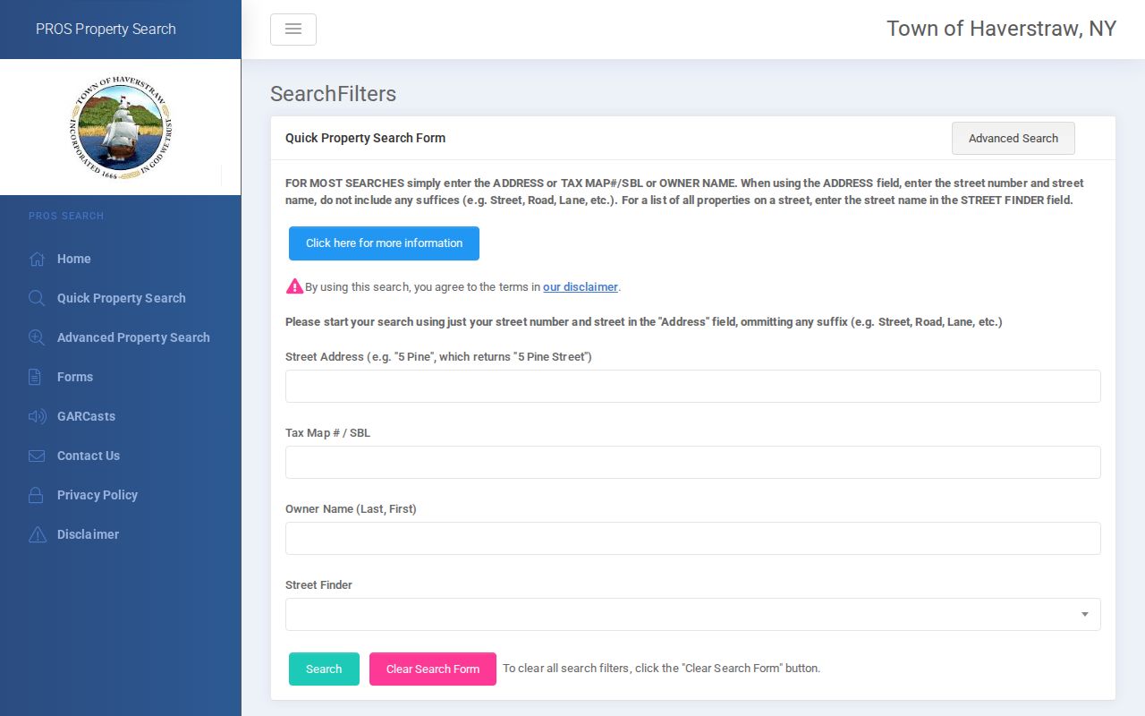
Record the difference between owner, mailing contact, and situs in separate columns. That distinction is the most important safeguard in a Haverstraw neighbors lookup.
Haverstraw Municipal Block Lines
Adjacent parcels can sit in different record systems. The Town includes the Villages of Haverstraw and West Haverstraw, plus part of Pomona. A block can also cross a ZIP or postal-place line. GIS municipal boundaries should be checked beside parcel lines before comparing tax records. A Village of Haverstraw parcel may require the Village assessor's annual roll, while a Town parcel can be found through PROS. Matching street names and mailing labels are not enough to merge those records.
Use a jurisdiction column in every block worksheet: Town of Haverstraw, Village of Haverstraw, Village of West Haverstraw, or the appropriate Pomona portion. Also record the postal place and ZIP separately. This lets an adjacent 10970 parcel be handled according to its Haverstraw or Ramapo municipality rather than its familiar Pomona label. A parcel next door may be physically close but administratively distinct.
GIS also displays election and political district layers. Those overlays provide block context, not a list of Haverstraw neighbors or a replacement for the official elections office.
Haverstraw Voter List Limits
New York Election Law section 5-602 makes names and residence addresses in election-district registration lists public, subject to the law's protections. That does not create a public block browser. The statewide Voter Lookup is an individual verification and poll-site tool: it requires county, last name, first name, date of birth, and address information, with ZIP as a narrowing field. Its result does not promise a complete voter record or an address-by-address browse function.
Election Law section 3-103(5) restricts information derived from voter-registration records to elections purposes. A request for voter-registration data must include an elections-purpose statement. Protected voters and Address Confidentiality Program participants have additional safeguards, and ballot choices are never public. For a block question, do not try to turn individual verification into a roster. Ask the Rockland Board of Elections about the lawful request route and retain only what is needed for the stated purpose.
A no-match means only that the entered information did not return a match. It is not proof that someone is not registered, moved away, or has no connection to the address.
Haverstraw Community Resources
Community resources can explain a public event, board item, local-history lead, or civic contact. They are not residential rosters. No verified official neighborhood-association directory or block-association roster was located for Haverstraw. The Town and Village public pages instead list departments, boards, parks, fire services, schools, cultural organizations, and local links. The North Rockland Chamber's member material is business and community context, not evidence of a private address.
| Community resource | Factual public role | Useful record context |
|---|---|---|
| Town of Haverstraw departmental hub | Links to boards, planning, zoning, parks, police, and records resources | Public municipal contacts and posted materials |
| Haverstraw Library Local History Room | Holds local photographs, yearbooks, newspapers, census images, and historical books | Historical address and community research requests |
| Rockland Room at New City Library | Provides county history, maps, telephone directories, and cross-reference directories | Historic block and address leads |
The Town of Haverstraw departmental hub is the source for its public department and community-resource links.
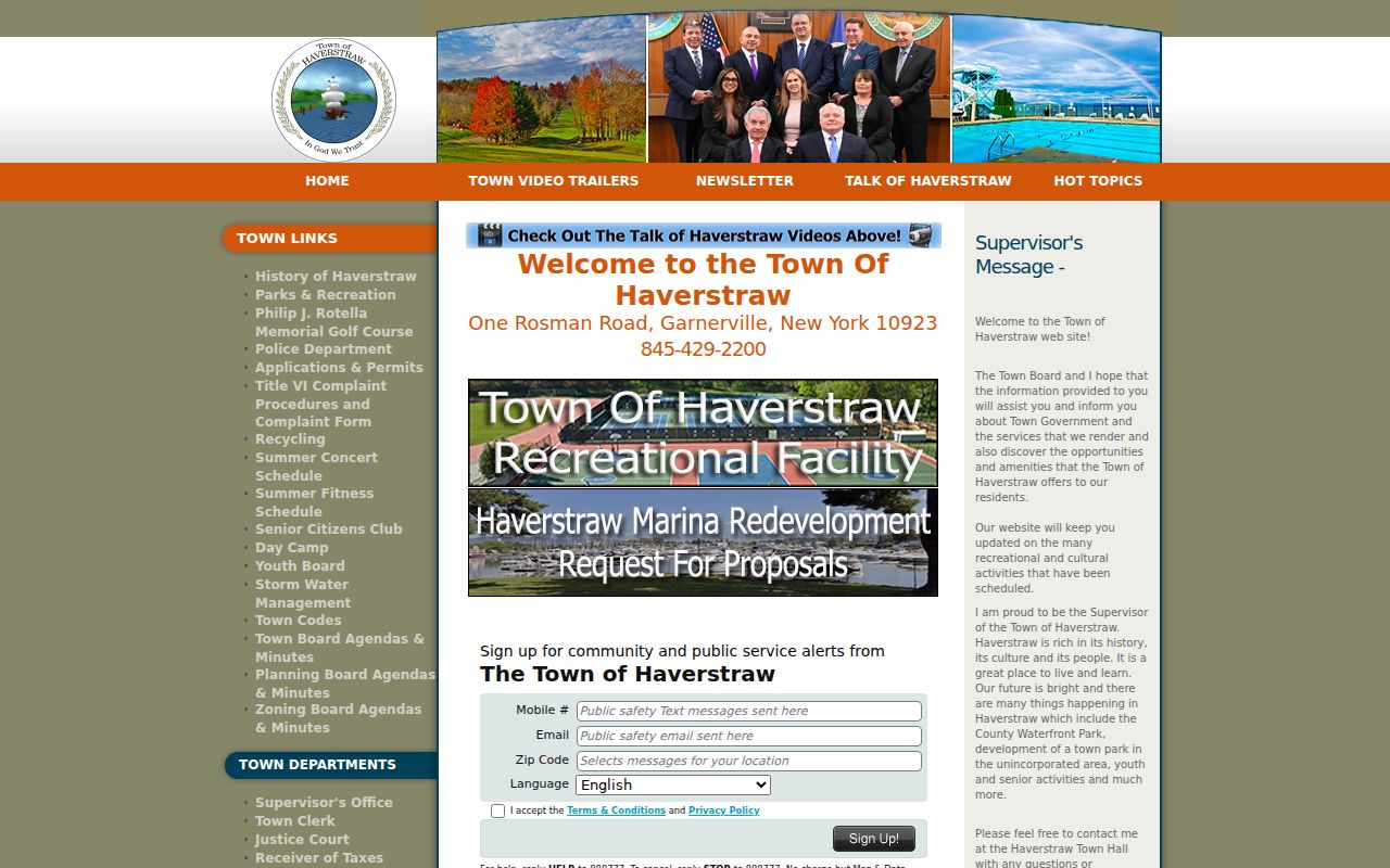
Use an organization record for the role it publishes, such as a public program or board activity. Do not infer a home address or private membership from it.
Haverstraw Neighbor Proof Limits
Seeing an owner name near an address does not prove that person is one of your Haverstraw neighbors. Official sources describe a specific relationship, and commercial neighbor-lookup categories may combine records of different dates and accuracy. The useful comparison is not which source offers more names. It is whether the source identifies a parcel, a recorded interest, a public historical address entry, or a current individual verification result.
| Official record category | Commercial neighbor-lookup category | Careful interpretation |
|---|---|---|
| GIS parcel layer | Map-based neighbor list | GIS shows parcel geometry and context, not verified occupancy. |
| Assessment roll or tax bill | Address-associated profile | Owner and mailing fields are not a household roster. |
| Recorded deed | Property-history summary | A deed records an interest at a date, not present-day use. |
| Published historical directory | Historical people search | A dated subscriber or address entry must remain dated and source-labeled. |
Lawful personal purpose. Use Haverstraw block records for personal, civic, or historical research. Do not watch, threaten, impersonate, publish sensitive details about, or harass anyone; New York Penal Law Article 120 addresses stalking and harassment conduct.
Historic Haverstraw Block Paths
Historical neighbors require a different sequence. Start with the address in Rockland cross-reference directories for 1978-99, record the printed year and subscriber entry, then compare it with deed grantors or grantees, obituary notices, and the 1910 Sanborn footprint. Haverstraw telephone books cover 1884-90, and broader Rockland telephone books cover 1910-98. Each is a dated publication, not a current parcel roll.
The November 1910 Haverstraw Sanborn set has 17 sheets. It can establish a building footprint, material, use, and street context, but it does not name a household. Pair it with a published directory or newspaper notice and label each fact by date. The Haverstraw Library's local-history room also holds selected census images, photographs, newspapers, and historical books, making it a practical handoff when a map or directory entry needs context.
For older material, preserve the location words used at the time. The Village was Warren from its 1854 incorporation until its 1874 rename to Haverstraw. Garnerville's factory neighborhood and the 1906 Rockland Street landslide can also explain a changed address trail. Search Warren, Haverstraw, village, station, street, and SBL forms together rather than assuming a modern block label existed in every source.