
Trace a Haverstraw Street
Start with the road, then narrow to a parcel. The Town of Haverstraw PROS Street Finder can return every address on a selected public road when the road is chosen without a number. That makes it a discovery tool, not proof of who is present at an address. Save the street spelling and section-block-lot number, often called an SBL, for each result. The SBL is the steadier bridge when a number, suffix, postal label, or municipal boundary becomes confusing.
- Choose the road in PROS Street Finder, then record the displayed address, SBL, owner field, prior-owner result if shown, and source year.
- Use the SBL or address in Rockland GIS. Turn on parcel, municipal-boundary, road, and district layers before treating a result as part of the same Haverstraw street.
- Check the current grantee deed in Cott with the owner name, legal description, or SBL. Record the grantor, grantee, recording date, instrument or book-page number, and legal description.
- For a lawful, known-voter verification question, use the New York lookup only with the required identity information. It is not a street browsing tool.
- For a dated household lead, check the Rockland cross-reference volumes and telephone directories, then preserve the printed address and date instead of calling it current.
That order separates parcel discovery, ownership verification, civic records, and historical publication evidence. A street-by-street result becomes more reliable when the record date remains beside the result.
Haverstraw Street Directory PROS Fields
The Town PROS property search accepts several useful ways into a street record. Street Address is optional and uses contains-text behavior. A search for “5 Pine” can return more than one number or suffix variation, so the road selector is better for making a street inventory. Tax Map number or SBL is the government parcel identifier. Owner Name accepts current or prior-owner matches, and an equals sign before a last name requests an exact last-name match.
| PROS field | Entry type | How it works |
|---|---|---|
| Street Address | Optional text | Use number plus name without a suffix. It can return contains-text matches. |
| Tax Map # / SBL | Optional text | Use the parcel number from a tax bill or assessment record. |
| Owner Name | Optional text | Search current or prior owner. Prefix an exact surname with =. |
| Street Finder | Optional dropdown | Selecting a road alone returns its addresses; pair it with a number to narrow one address. |
| Advanced Search | Link or tab | Opens additional portal options whose dynamic fields were not published in the inspected text. |
A Town PROS search screen shows the street, SBL, owner, and Street Finder routes used for Haverstraw address research.
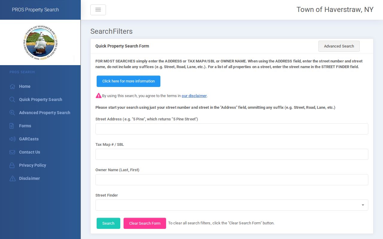
Use the returned parcel record as a starting point, then confirm the owner field against the recorded deed rather than treating a search row as title evidence.
Haverstraw Address Records Coverage
Several keepers hold pieces of an address history. The Town assessment roll and PROS provide the local parcel view, while the Village of Haverstraw maintains its own assessor route and roll PDFs. The County Clerk keeps deeds, mortgages, satisfactions, and assignments. A tax bill is useful for its bill and payment context, but it is not title. Municipal permit material may supply a dated work or application record, yet no public searchable Town or Village permit index was located.
| Address source | Record keeper | Useful fields | Access path |
|---|---|---|---|
| Assessment roll and PROS | Town Assessor | Owner, mailing address, situs, SBL, class, assessment, exemption | Free PROS, annual PDFs, counter or phone |
| Village assessment roll | Village Assessor | Parcel owner and assessment fields for Village parcels | Published 2024 through 2026-27 roll PDFs and assessor contact |
| Tax bill and payment | Town Receiver of Taxes | Bill, tax map, owner or address, receipt, collection year | Free BAS portal |
| Land index | Rockland County Clerk | Grantor, grantee, instrument, date, legal description, consideration | Cott guest view, account prints, counter or mail copies |
| Building or board file | Town or Village office | Owner or applicant, work description, tax map, inspections, certificates | Existing-record request or FOIL |
The Town BAS tax search has collection, bill number, tax map, property address, and owner-name fields. It states that current bills and receipts and five years of Town payment history are viewable or printable. County-posted delinquent payments may not appear there.
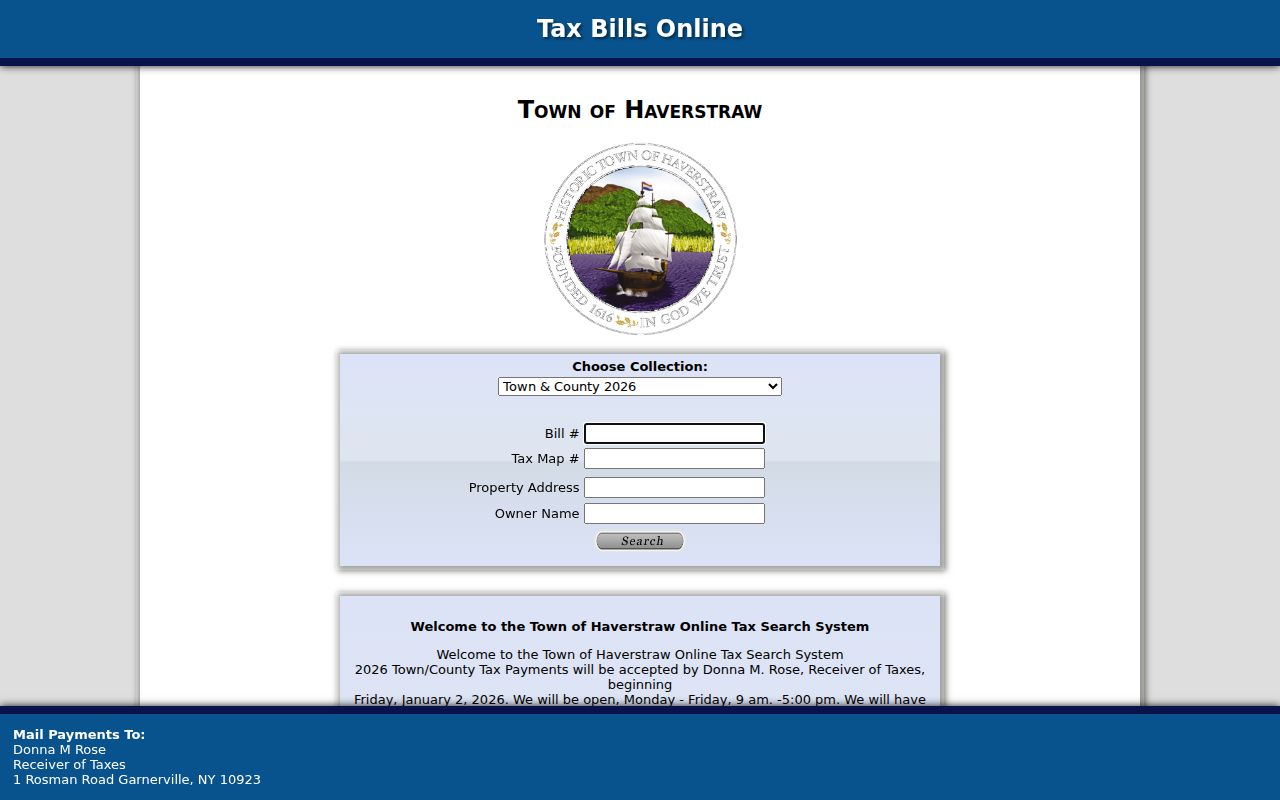
A tax-search result supports the parcel chronology, but the recorded instrument and assessment source remain the better checks for ownership and parcel identity.
Haverstraw GIS Street Context
Rockland GIS makes the spatial check that a text search cannot. Search by address or Tax ID, turn on the Tax Parcel and municipal-boundary layers, then note roads, election or political districts, land use, topography, environmental information, and historic-resource layers where relevant. Selecting adjacent polygons supplies their addresses and Tax IDs. Copy an SBL from the selected parcel instead of relying on where a cursor happens to land.
The county maintains more than 90,000 parcels, but its GIS disclaimer says the data are not a survey, title record, or verified owner source. The portal is discovery evidence. Confirm its parcel geometry and owner clue in the assessment record and County Clerk index. Its municipal layer is especially important where a street is near a Village line or the Haverstraw portion of Pomona.
A Rockland GIS parcel-viewer screen illustrates the layer-based route from a Haverstraw street to its mapped parcel context.
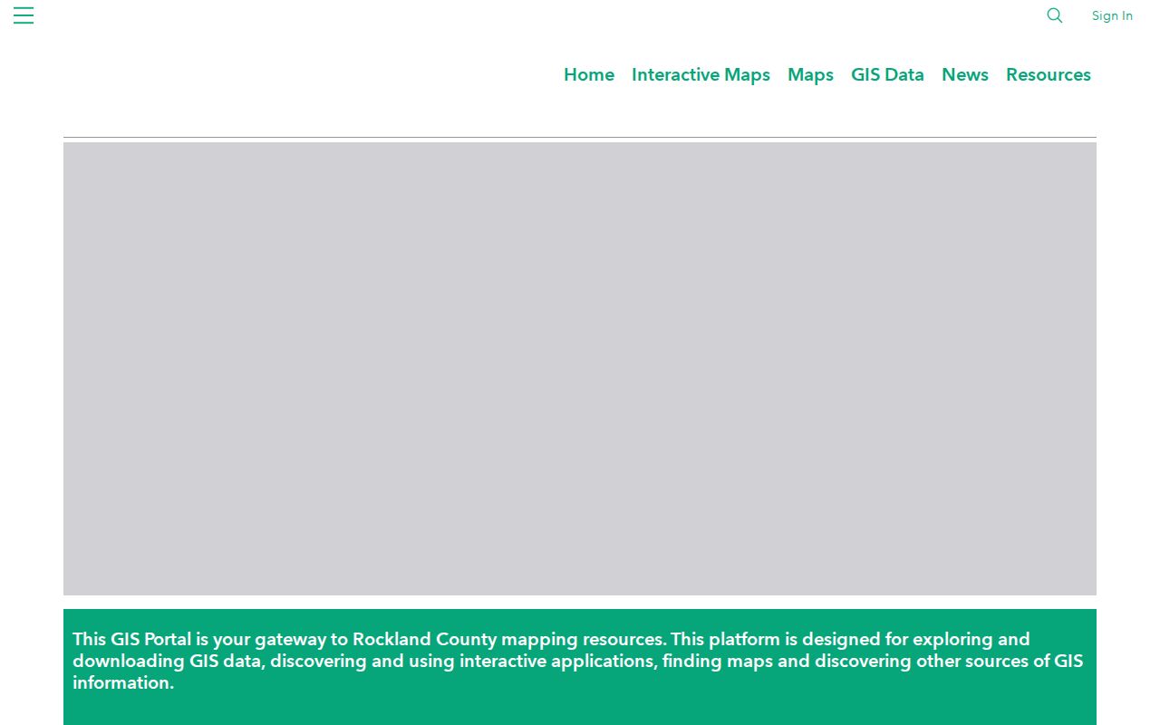
The map can expose a boundary or adjacent lot that a street-name result hides, but it cannot replace a deed or assessor confirmation.
Haverstraw Parcel Deed Checks
The recorded deed is the next check after PROS and GIS agree on the parcel. In Rockland County Cott eSearch, find the current grantee with the name, address or legal description available, then compare the instrument's grantor, grantee, recording or file date, document number, legal description, and consideration or transfer-tax information. The Clerk cautions that section-block-lot references in Cott are not verified, so the local assessor remains the parcel validator.
The seller in the current deed becomes the next search name for an older purchase. That sequence can trace a recorded title interest backward, but it does not establish daily presence at the property. Deeds may name a trust, estate, corporation, or more than one party. The legal description is the durable part of the match when the street wording differs.
Cott's guest page states that document viewing is free. Printing images requires a registered account and costs $0.50 per page.
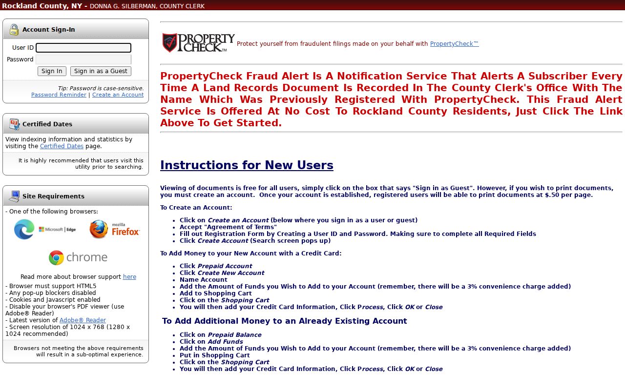
The Certified Dates utility should be checked before assuming a deed image is online. The research did not locate a current exact online cutoff table.
Haverstraw Street Record Terms
Street research uses several similar-looking address fields. Keeping them separate avoids turning an owner contact field or map label into a claim about who is at a location.
- Parcel or SBL
- The assessor's section-block-lot identifier for a parcel. It is the most stable local bridge between the roll, map, and deed research.
- Situs address
- The physical parcel location used by the assessor, GIS, permits, and Sanborn maps.
- Tax mailing address
- The address used for tax notices. It can be off-parcel, a post office box, an out-of-state address, or a business contact.
- Legal description
- The lot, block, SBL, subdivision, or metes-and-bounds description used in deeds and plats. It can survive street-label changes.
- Criss-cross directory
- A reverse directory arranged from address to subscriber or published occupant clue for a particular year.
The annual roll also displays parcel class, assessments, exemptions, school and special districts, coordinates, account number, and tax description. A homestead notation or exemption can be an owner-occupancy clue, not proof of a person's residence.
Haverstraw Street Voter Boundaries
New York's public registration-list elements include a registered voter's name and residence address by election district under Election Law §5-602. That rule does not turn the statewide lookup into a public street roster. The NYS Voter Lookup requires county, first name, last name, date of birth, and address information for a registered voter. A matching result is designed for registration, poll-site, and mail-ballot status, not for browsing every address on a road.
Election Law §3-103(5) restricts voter-registration information to elections purposes. Protected voters and Address Confidentiality Program participants have additional safeguards, and ballot choices are never public. A no-match only means the entered details did not produce a match. For a legitimate list request, contact the Rockland Board of Elections with the requested records, district or date, format, and stated elections purpose rather than attempting to automate individual checks.
Note: Retain only the result needed for a lawful purpose, and do not copy a person's date of birth or publish lookup inputs.
Haverstraw Street Files by FOIL
Construction and board records can add dates that a tax roll cannot. A permit, certificate of occupancy, complaint, Planning Board, ZBA, or ARB file may name an owner or applicant and describe work at a street address. The Village Building Department publishes forms and contact information, but the research found no public searchable municipal permit index. Ask for an existing file by street address, SBL, file type, and date range.
Use the Rockland FOIL procedure for county-held material and the relevant Town or Village records route for local material. New York FOIL concerns existing records. It does not require an office to assemble a new list of people at an address. Redactions can apply, and a permit applicant should be described as an applicant rather than assumed to be a current resident.
Note: When an online property result is absent, test the municipality, street spelling, suffix, nearby number, GIS parcel, and recent parcel changes before drawing a conclusion.
Haverstraw Street Directory History
For a past address, the local reverse shelf is most useful after the parcel trail is set. Rockland cross-reference directories cover 1978 through 1999 and can turn an address into a dated subscriber or occupant lead. Haverstraw telephone books cover 1884 through 1890, while broader Rockland telephone books run from 1910 through 1998. The printed date and spelling matter because a directory is a snapshot, not a deed or current record.
Older material can use Warren, Haverstraw Village, West Haverstraw, Garnerville, a railroad station, or another historic label. The original Village of Haverstraw was incorporated as Warren in 1854 and renamed Haverstraw in 1874. Search both names and preserve the form printed in the record. The historical collections themselves are described on the Haverstraw city directories page.
Haverstraw Streets and Postal Places
Postal place and municipal record keeper are not interchangeable. A Town parcel can use Garnerville 10923, Haverstraw 10927, Pomona 10970, Thiells 10984, or West Haverstraw 10993. Pomona is split between the Towns of Haverstraw and Ramapo. A familiar postal city therefore cannot select the correct assessment system or establish jurisdiction by itself.
Verify the address with USPS, then use GIS and the parcel record to identify the municipality. PROS has no visible ZIP search field, and BAS likewise shows address, owner, tax map, bill, and collection fields rather than a ZIP field. This sequencing prevents a postal label from routing a Haverstraw street search to the wrong office.
Haverstraw Street Privacy Boundaries
A public parcel result does not disclose every person connected to a house. Utility customer information is not a general public street list, DMV personal-address data are protected, and protected voter addresses are not a substitute for a map or roll entry. A current owner, tax contact, deed party, historical subscriber, and registered voter each represent different evidence at different dates.
Keep street research bounded to a specific personal, civic, archival, or property-history question. Do not publish personal phone numbers, dates of birth, protected voter information, or a scraped block roster. If an official record is wrong, contact the office that created it with the parcel, instrument, or file number so the source can address the error.